PREDICTIVE MAPPING PLATFORM
STATE & LOCAL GOVERNMENT
Predict real issues in the community using geographic information
REQUEST DEMOLower Crime Rate
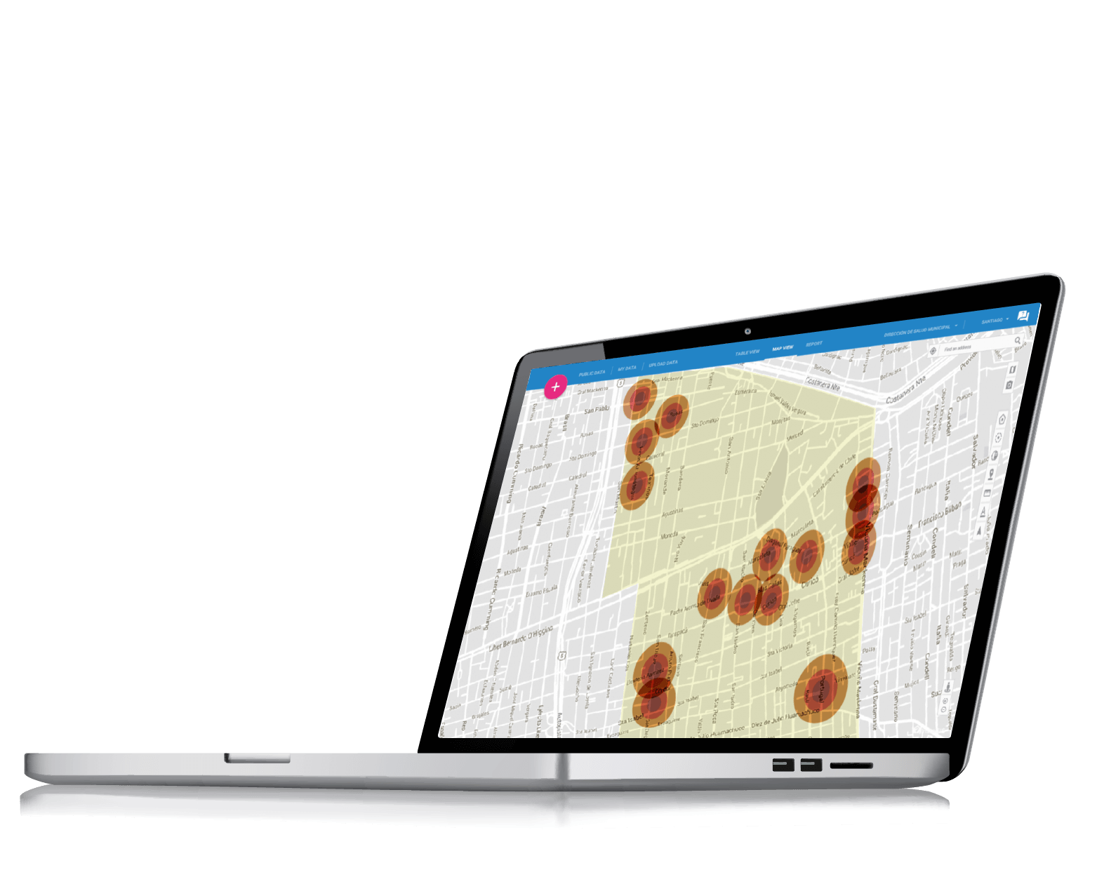
Map crimes easily, generate heat maps to see concentration points and estimate the affected population using census information preloaded into InstaGIS. Monitor law enforcement vehicles online and optimize their patrol routes.
Share your town's attractions
Shops, grocery stores, services and municipal offices, are shared on a map so that anyone can discover relevant places in their town or neighborhood using a computer, tablet or smartphone.
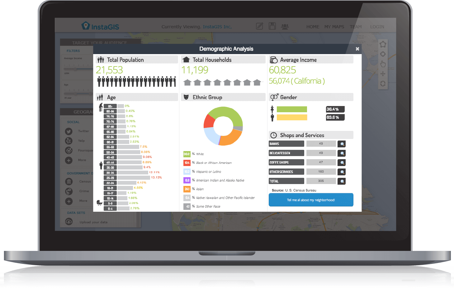
Profile your town's population
Before making any decisions it is crucial to understand neighborhoods and their demographic profile, to assess the real needs that people have.
Taxpayers data enrichment
Centralize taxpayer information and display it geographically with just a click. Discover detailed information about the neighborhood where they live and develop a socioeconomic profile and of the neighborhood for future marketing activities.
One-click citizen participation
We will help you keeping your citizens' email addresses up to date so you can generate emailing campaigns inviting them to participate in the city council's activities, or or surveying their opinion on new developments.
A platform tailored to your needs
A web platform, easy to use and specially designed so that any local government division or public entity can perform autonomous analysis of their region. InstaGIS will validate their decisions with relevant territorial information
InstaGIS use cases

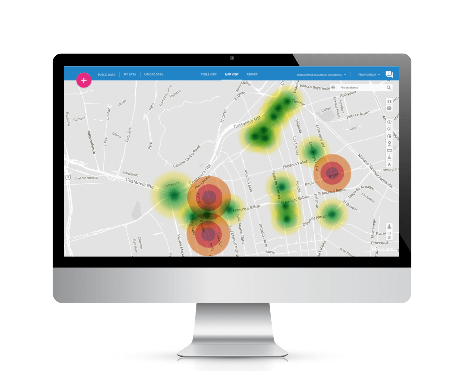
We use InstaGIS to generate isochrones and and to diagnose zones with the socioeconomic profile obtained from the platform, as well as geocoding crime occurences.
The isochrones are obtained by geocoding the location of each of our field security agents, given they all use GPS.
By Cross-referencing the data one can identify high risk areas, according to the number of crimes committed and available security staff in the area. With this tool, you can easily relocate your staff to achieve greater success in crime prevention.
- Direction of Citizen Security for Municipality of Providencia

We are now able to analyze our geocoded information on a map whereas we could only list it on a spreadsheet, which allows us to look at people’s distribution, filtering and further sorting the information by age ranges and according our interests
- Direction of Community Development for Municipality of Vitacura

We geocoded alcohol permits, crime occurences and damages to public spaces caused by the abuse of this substance, reported to the Hello Santiago program. This is how we identified four places -basing our analysis on the superposition of several heat maps-, which allowed us to narrow down the targets of our interventions, identify the key players for a successful citizen involvement and design a public policy based on the territorial layout.
- Direction of Health for Municipality of Santiago